

 Deutsch


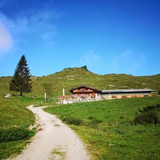
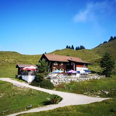
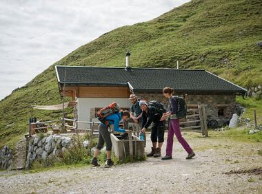
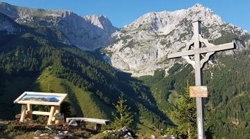
Steiner Hochalm

Cosed - Open from 18.05.2024
Scheffau am Wilden Kaiser
(0043) 68184721696
Read more
The composition of the trail varies between forest roads, paths, meadow and forest trails, rocky passages with some sections secured by ropes and short sections of asphalt.
Rucksack, sturdy hiking/mountaineering boots with anti-slip treaded soles, weather-appropriate hiking gear (breathable), a change of clothes, sun protection (sunglasses, sun cream, lip protection, headgear), waterproofs (rain jacket/poncho, pocket umbrella, rucksack protector), cold protection (hat, gloves), sufficient food and drink, hiking poles (height adjustable) if required, first aid kit incl. rescue blanket and bivouac sack, mobile phone with fully charged battery, headlamp, plastic bag for waste, hiking map, route description and information materials (GPX track), ID, insurance card, cash
Additions for overnight stay at mountain hut:
Mountain hut sleeping bag, indoor shoes, toiletries and towel, personal medication, headlamp, Alpine Club ID Card, cash, charger for mobile phone
The hiking routes between the huts are often rather long, we recommend taking plenty of food and drink and booking your overnight stays well in advance.
Read more
Next bus stop for the access to stage 2:
Ellmau Dorf/Bauhof and with the hiking bus Wochenbrunner Alm to the hiking bus stop Wochenbrunner Alm.
Next bus stop at the end of stage 2: Scheffau Bärnstatt, Hintersteiner See or Pension Maier.
From here, take the Hintersteiner See hiking bus to the Scheffau Dorf bus stop and continue with the KaiserJet or public buses.
More information at: www.wilderkaiser.info/mobility
Read more
Fitness
Technical
Experience
01
Jan
02
Feb
03
Mrz
04
Apr
05
May
06
Jun
07
Jul
08
Aug
09
Sep
10
Oct
11
Nov
12
Dec
Cosed - Open from 18.05.2024
Scheffau am Wilden Kaiser
(0043) 68184721696
Open - Today 08:30 - 17:00
Scheffau am Wilden Kaiser
(0043) 664 9858139

Scheffau am Wilden Kaiser
+43 (0) 664 5249441
Open - Today 10:00 - 22:00
Kufstein
(0043) 5372 21255
Old path - now renovated and featuring a pleasant series of ascents and descents.
Hiking starting point Bergbahn, Söll (725 m)
Hiking starting point Bergbahn, Söll (725 m)
Hiking
Intermediate
4:30 h
13,5 km
470 Elevation gain
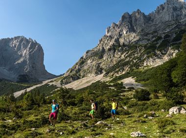
Wilder Kaiser hike to a series of special locations. Featuring the natural spectacle of the Schleier Waterfall and a view of the Gaudeamushütte mountain hut.
Hüttling, Going (820 m)
Hüttling, Going (820 m)
Hiking
Intermediate
6:00 h
13,6 km
980 Elevation gain
Over hill and dale through idyllic nature up to the Rauhen Kopf.
Astberg Bergstation
Astberg Bergstation
Hiking
Intermediate
4:45 h
13,1 km
620 Elevation gain
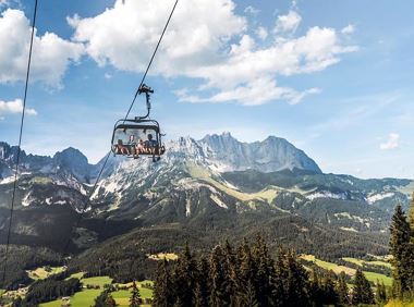
A unique hike to the highest mountain hut in the Wilder Kaiser region featuring a panoramic view.
Hiking starting point Going center (former tourist information Going) (764 m)
Hiking starting point Going center (former tourist information Going) (764 m)
Hiking
Intermediate
6:00 h
14,0 km
890 Elevation gain
Sturdy boots will help keep your ankles and feet happy on this hike, full of the best things Tirol has to offer: well-maintained trails, wildflowers galore and waterfalls beckon the adventurous
Rummlerhof, St.Johann in Tirol
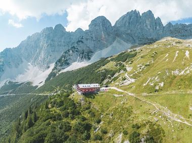
Gaudeamushütte
Hiking
Intermediate
5:00 h
13,0 km
1060 Elevation gain
Alpine pasture circular hiking route with a breathtaking view over Scheffau!
Hiking starting point Tourist Info, Scheffau (738 m)
Hiking starting point Tourist Info, Scheffau (738 m)
Hiking
Intermediate
5:15 h
12,9 km
800 Elevation gain
2024-05-13
10 °C
2024-05-14
21 °C
2024-05-15
19 °C
2024-05-16
20 °C