


 Deutsch


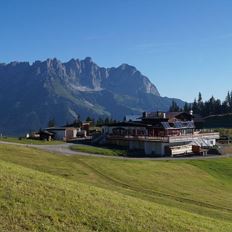
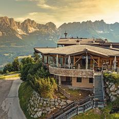
Blattlalm at the Astberg
Cosed - Open from 30.05.2024
Going am Wilden Kaiser
(0043) 5358 2713
Read more
The composition of the trail varies between asphalt, forest road, road, path, meadow path, forest trail.
Rucksack, sturdy hiking/mountaineering boots with anti-slip treaded soles, weather-appropriate hiking gear (breathable, sun protection (sunglasses, sun cream, lip protection, headgear), waterproofs (rain jacket/poncho, pocket umbrella, rucksack protector), cold protection (hat, gloves), sufficient food and drink, hiking poles (height adjustable), mobile phone with fully charged battery, plastic bag for waste, ID, insurance card, cash
Read more
KaiserJet stop “Going Astbergbahn”.
More information at: www.wilderkaiser.info
Heading from Wörgl or Kufstein on the B178 road, take the first exit on the right after Ellmau – this leads to the Astbergbahn chairlift. Turn left at the end of this road. You will reach the Astbergbahn chairlift after approx. 300 m.
Heading from St. Johann on the B178 road, take the first exit on the left after Going (Hotel Blattlhof) – this leads to the Astbergbahn chairlift. Turn left again at the end of this road. You will reach the Astbergbahn chairlift after approx. 300 m.
Car park Astbergbahn chairlift valley station, Going (805 m) – free
Read more
Fitness
Technical
Experience
01
Jan
02
Feb
03
Mrz
04
Apr
05
May
06
Jun
07
Jul
08
Aug
09
Sep
10
Oct
11
Nov
12
Dec
Cosed - Open from 30.05.2024
Going am Wilden Kaiser
(0043) 5358 2713
Ellmau
+43 5358 43919
Sturdy boots will help keep your ankles and feet happy on this hike, full of the best things Tirol has to offer: well-maintained trails, wildflowers galore and waterfalls beckon the adventurous
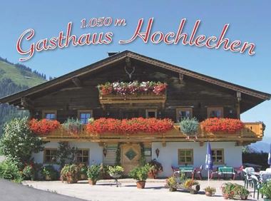
Rummlerhof, St.Johann in Tirol
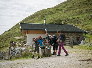
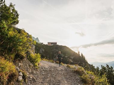
Gaudeamushütte
Hiking
Intermediate
5:00 h
13,0 km
1060 Elevation gain
Alpine pasture circular hiking route with a breathtaking view over Scheffau!
Hiking starting point Tourist Info, Scheffau (738 m)
Hiking starting point Tourist Info, Scheffau (738 m)
Hiking
Intermediate
5:15 h
12,9 km
800 Elevation gain
Old path - now renovated and featuring a pleasant series of ascents and descents.
Hiking starting point Bergbahn, Söll (725 m)
Hiking starting point Bergbahn, Söll (725 m)
Hiking
Intermediate
4:30 h
13,5 km
470 Elevation gain
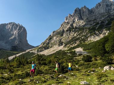
Gruttenhütte - Kaiser-Hochalm - Steiner-Hochalm - Jägersteig - Walleralm - Hochegg - Kaindlhütte
Gruttenhütte, Ellmau (1,620 m)
Hintersteiner See, Scheffau (889 m)
Hiking
Intermediate
5:30 h
13,5 km
560 Elevation gain
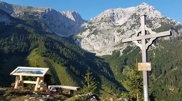
Wilder Kaiser hike to a series of special locations. Featuring the natural spectacle of the Schleier Waterfall and a view of the Gaudeamushütte mountain hut.
Hüttling, Going (820 m)
Hüttling, Going (820 m)
Hiking
Intermediate
6:00 h
13,6 km
980 Elevation gain
This stage takes hikers to the small town of Kufstein located on the banks of the Inn river – a town which has been celebrated in song and is steeped in history and character. Walkers make their way
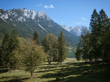
Hintersteiner See
Kufstein
Hiking
Intermediate
4:00 h
12,5 km
160 Elevation gain
2024-05-13
18 °C
2024-05-14
21 °C
2024-05-15
20 °C
2024-05-16
20 °C
