


 Deutsch


Wegscheid car park, Scheffau (subject to charge)

Open - Today
Scheffau am Wilden Kaiser
Read more
The composition of the trail varies between forest road, trail, meadow path, forest trail, rocky passages with some sections secured by ropes and short climbing sections.
Rucksack, sturdy hiking/mountaineering boots with anti-slip treaded soles, weather-appropriate hiking gear (breathable), a change of clothes, sun protection (sunglasses, sun cream, lip protection, headgear), waterproofs (rain jacket/poncho, pocket umbrella, rucksack protector), cold protection (hat, gloves), sufficient food and drink, hiking poles (height adjustable) if required, first aid kit incl. rescue blanket and bivouac sack, mobile phone with fully charged battery, headlamp, plastic bag for waste, hiking map, route description and information materials (GPX track), ID, insurance card, cash; helmet
Read more
KaiserJet/Postbus stop “Scheffau Dorf” – followed by approx. 30-minute hike to Wegscheid car park.
More information at: www.wilderkaiser.info
Heading from Wörgl, Kufstein or St. Johann on the B178 road, take the exit to Scheffau. When you reach the Gasthof Maikircher inn located in the village of Scheffau, turn right in the direction of the Restaurant Jägerwirt. Follow the road until you reach the car park Wegscheid, below the Restaurant Jägerwirt.
Wegscheid car park, Scheffau (883 m) – pay & display
Read more
Fitness
Technical
Experience
01
Jan
02
Feb
03
Mrz
04
Apr
05
May
06
Jun
07
Jul
08
Aug
09
Sep
10
Oct
11
Nov
12
Dec
Open - Today
Scheffau am Wilden Kaiser
Scheffau am Wilden Kaiser
(0043) 5358 86700
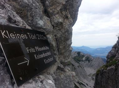
Demanding mountain tour to the Kleines Törl pass, the little brother of the Ellmauer Tor in the Ostkaiser.
Hiking starting point Tannbichl, Going (855 m)
Hiking starting point Tannbichl, Going (855 m)
Hiking
Difficult
8:00 h
12,0 km
1260 Elevation gain
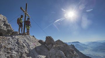
A demanding mountain tour with some ferrata passages up to the highest summit in the Wilder Kaiser (2,344 m).
Hiking starting point Wochenbrunner Alm, Ellmau (1,085 m)
Hiking starting point Wochenbrunner Alm, Ellmau (1,085 m)
Hiking
Difficult
7:30 h
9,3 km
1250 Elevation gain
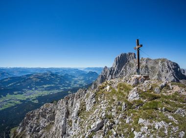
Very demanding round tour to the two eastern peaks in the Wilder Kaiser.
Hiking starting point Tannbichl, Going (857 m)
Hiking starting point Tannbichl, Going (857 m)
Hiking
Difficult
9:00 h
13,0 km
1570 Elevation gain
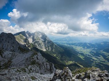
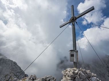
Varied and challenging loop over the Scheffauer summit.
Kaindlhütte, Scheffau (1,293 m)
Scheffauer (2,111 m)
Hiking
Difficult
8:30 h
13,0 km
1400 Elevation gain
The Hintere Goinger Halt (2,193 m) is considered to be the easiest summit to reach in the Wilder Kaiser.
Hiking starting point Wochenbrunner Alm, Ellmau (1,085 m)
Hiking starting point Wochenbrunner Alm, Ellmau (1,085 m)
Hiking
Difficult
6:30 h
8,9 km
1090 Elevation gain
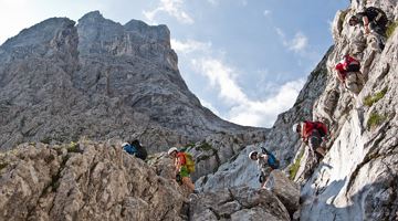
Approaching from the north, this trail leads through the Steinerne Rinne to the majestic Ellmauer Tor.
Griesner Alm, 988 m
Wochenbrunner Alm, Ellmau (1,085 m)
Hiking
Difficult
5:45 h
8,1 km
1060 Elevation gain
2024-05-14
16 °C
2024-05-15
19 °C
2024-05-16
19 °C
2024-05-17
14 °C
