

 Deutsch


Lake Hintersteiner See car park, Scheffau (subject to charge)

Open - Today
Scheffau am Wilden Kaiser
Read more
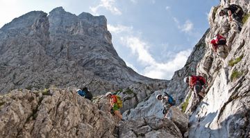
The composition of the trail varies between forest roads, meadow paths, forest trails, trails, rocky passages with some sections secured by ropes and short sections on asphalt.
Rucksack, hiking/mountaineering boots, hiking gear (breathable), change of clothes, sun protection (sunglasses, sun cream, headgear), waterproofs (hardshell), cold protection (gloves and hat), water bottle, food for eating on the way, hiking poles if desired, first aid kit, plastic bag for waste, hiking map/route description (gpx track)Via ferrata set, climbing harness and helmet;
Read more
Go to KaiserJet/Postbus stop “Scheffau Dorf”, then ride the Hintersteiner See lake bus to “Seestüberl Strandbad”. More information at: www.wilderkaiser.info
Heading from Wörgl, Kufstein or St. Johann on the B178 road, take the exit to Scheffau and drive through the village as you continue in the direction of the Hintersteiner See. The hiking starting point and the pay & display car park are located next to the Seestüberl restaurant on the eastern bank of the lake.
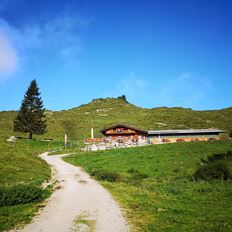
Car park next to Seestüberl restaurant, Scheffau (889 m) – pay & display
Read more
Fitness
Technical
Experience
01
Jan
02
Feb
03
Mrz
04
Apr
05
May
06
Jun
07
Jul
08
Aug
09
Sep
10
Oct
11
Nov
12
Dec
Open - Today
Scheffau am Wilden Kaiser

Open - Today 08:00 - 17:00
Scheffau am Wilden Kaiser
+43 (0) 664 5249441
Open - Today 10:00 - 22:00
Kufstein
(0043) 5372 21255

Cosed - Open from 18.05.2024
Scheffau am Wilden Kaiser
(0043) 68184721696
Open - Today 11:30 - 14:00, 17:30 - 19:30
Scheffau am Wilden Kaiser
(0043) 5358 8113
Scheffau am Wilden Kaiser
(0043) 5358 8191
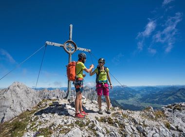
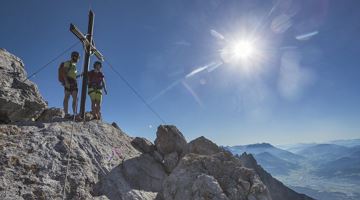
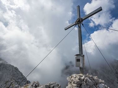
Very demanding round tour to the two eastern peaks in the Wilder Kaiser.
Hiking starting point Tannbichl, Going (857 m)
Hiking starting point Tannbichl, Going (857 m)
Hiking
Difficult
9:00 h
13,0 km
1570 Elevation gain
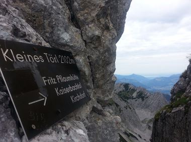
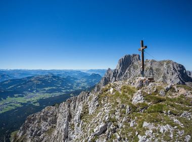
Demanding mountain tour to the Kleines Törl pass, the little brother of the Ellmauer Tor in the Ostkaiser.
Hiking starting point Tannbichl, Going (855 m)
Hiking starting point Tannbichl, Going (855 m)
Hiking
Difficult
8:00 h
12,0 km
1260 Elevation gain
Two very demanding, fantastic lookout peaks on the Wilder Kaiser, which are not to be underestimated.
Hiking starting point Wegscheid, Scheffau (883 m)
Hiking starting point Wegscheid, Scheffau (883 m)
Hiking
Difficult
9:00 h
11,0 km
1440 Elevation gain
A demanding mountain tour with some ferrata passages up to the highest summit in the Wilder Kaiser (2,344 m).
Hiking starting point Wochenbrunner Alm, Ellmau (1,085 m)
Hiking starting point Wochenbrunner Alm, Ellmau (1,085 m)
Hiking
Difficult
7:30 h
9,3 km
1250 Elevation gain
The Hintere Goinger Halt (2,193 m) is considered to be the easiest summit to reach in the Wilder Kaiser.
Hiking starting point Wochenbrunner Alm, Ellmau (1,085 m)
Hiking starting point Wochenbrunner Alm, Ellmau (1,085 m)
Hiking
Difficult
6:30 h
8,9 km
1090 Elevation gain
Approaching from the north, this trail leads through the Steinerne Rinne to the majestic Ellmauer Tor.
Griesner Alm, 988 m
Wochenbrunner Alm, Ellmau (1,085 m)
Hiking
Difficult
5:45 h
8,1 km
1060 Elevation gain
2024-05-14
21 °C
2024-05-15
19 °C
2024-05-16
18 °C
2024-05-17
13 °C