


 Deutsch


Parking lot Schedererfeld, Going

Open - Today
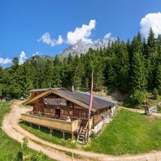
Going am Wilden Kaiser
Read more
The composition of the trail varies between forest road, trail, cart path, mountain trail, meadow path, gravel, forest trail, rocky passages with some sections secured by ropes.
Rucksack, sturdy hiking/mountaineering boots with anti-slip treaded soles, weather-appropriate hiking gear (breathable), a change of clothes, sun protection (sunglasses, sun cream, lip protection, headgear), waterproofs (rain jacket/poncho, pocket umbrella, rucksack protector), cold protection (hat, gloves), sufficient food and drink, hiking poles (height adjustable) if required, first aid kit incl. rescue blanket and bivouac sack, mobile phone with fully charged battery, headlamp, plastic bag for waste, hiking map, route description and information materials (GPX track), ID, insurance card, cash
Additions for overnight stay at mountain hut:
Mountain hut sleeping bag, indoor shoes, toiletries and towel, personal medication, headlamp, Alpine Club ID Card, cash, charger for mobile phone
The hiking routes between the huts are often rather long, we recommend taking plenty of food and drink and booking your overnight stays well in advance.
Read more
Hiking bus KaiserJet Stops: Ellmau Dorf/Bauhof, Going Dorf or Going Badesee.
Public bus stops: Going Dorf or Going Stanglwirt
From the Schedererfeld car park or the "Going Dorf" bus stop, continue with the "Hüttling Hiking Bus" free of charge to the starting point of the Kaiserkrone to Going Hüttling.
More information at: www.wilderkaiser.info/mobility
Heading from Wörgl or Kufstein on the B178 road, take the exit to Going. Pass the Tourist Information office and turn sharply right just after the bridge. Pass the supermarket "M-Preis" and turn left after the "Schedererhaus" and immediately right again in front of the ski school.
Heading from St. Johann on the B178 road, take the first exit to Going and drive through the village. Before the bridge turn diagonally left. Pass the supermarket "M-Preis" and turn left after the "Schedererhaus" and immediately right again in front of the ski school.
Read more
Fitness
Technical
Experience
01
Jan
02
Feb
03
Mrz
04
Apr
05
May
06
Jun
07
Jul
08
Aug
09
Sep
10
Oct
11
Nov
12
Dec
Open - Today
Going am Wilden Kaiser
Cosed - Open from 19.05.2024
Going am Wilden Kaiser
(0043) 664 88690750
Cosed - Open from 15.05.2024
Going am Wilden Kaiser
(0043) 5358 2262
Cosed - Open from 25.05.2024
Ellmau
(0043) 5358 43389
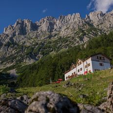
Stripsenjochhaus - Griesner Alm - Griesenau
Stripsenjochhaus (1,577 m)
Griesenau, Kirchdorf (719 m)
Hiking
Intermediate
3:00 h
7,9 km
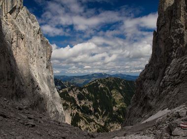
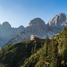
Challenging adventure hike to the Ellmauer Tor
Hiking starting point Wochenbrunner Alm, Ellmau (1,085 m)
Ellmauer Tor, Ellmau (2,001 m)
Hiking
Intermediate
5:00 h
7,7 km
900 Elevation gain
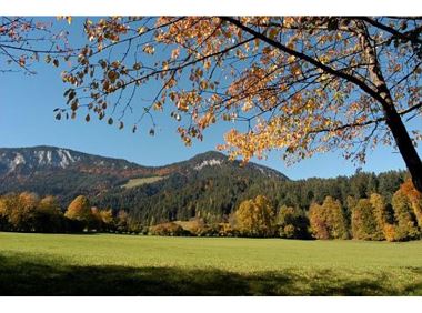
The panoramic spot of the locals, steep and fascinating.
Hiking starting point Franzlhof, Söll (703 m)
Hiking starting point Franzlhof, Söll (703 m)
Hiking
Intermediate
5:00 h
8,5 km
880 Elevation gain
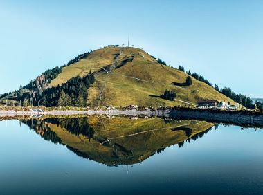
mountain station Salvistabahn / Kleine Salve
Middle station Salvistabahn Itter
Hiking
Intermediate
2:45 h
7,4 km
360 Elevation gain
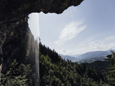
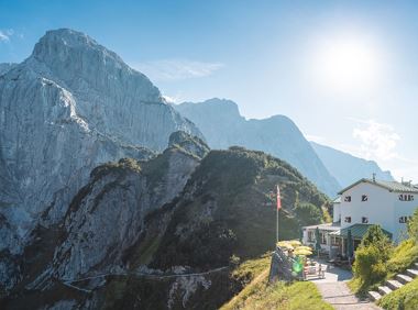
Going, Hüttling - Schleierwasserfall - Obere Regalm - Baumgartenköpfl (Bergsteigergrab) - Gaudeamushütte
Hiking starting point Hüttling, Going (820 m)
Gaudeamushütte, Going (1,263 m)
Hiking
Intermediate
4:00 h
7,3 km
860 Elevation gain
Themed hiking route with a trail full of natural experiences alongside the refreshing water.
Hiking starting point Tourist Info, Scheffau (738 m)
Hiking starting point Tourist Info, Scheffau (738 m)
Hiking
Intermediate
2:30 h
7,2 km
300 Elevation gain
2024-05-12
10 °C
2024-05-13
17 °C
2024-05-14
20 °C
2024-05-15
19 °C

