

 Deutsch


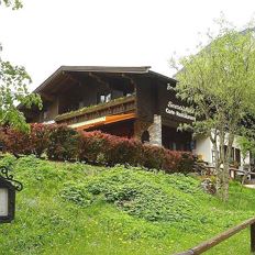
Community hall Scheffau car park

Open - Today
Scheffau am Wilden Kaiser
Read more
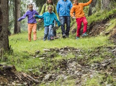
The composition of the trail varies between forest road, hiking trail and forest trail, with a short section of asphalt.
Rucksack, sturdy hiking shoes, weather-appropriate hiking gear, sun protection, waterproofs, snack and drink, hiking poles (height adjustable) if required, mobile phone, plastic bag for waste, hiking map, route description and information materials (GPX track), ID, cash
Read more
KaiserJet/Postbus stop “Scheffau Dorf”.
More information at: www.wilderkaiser.info/mobil
Heading from Wörgl, Kufstein or St. Johann on the B178 road, take the exit to Scheffau. Shortly before you come to the church, you will see the Tourist Info and the hiking starting point on the left-hand side (short-stay parking zone).
Public car park, Scheffau (740 m), north of the Community Hall - free
Read more
Fitness
Technical
Experience
01
Jan
02
Feb
03
Mrz
04
Apr
05
May
06
Jun
07
Jul
08
Aug
09
Sep
10
Oct
11
Nov
12
Dec
Open - Today
Scheffau am Wilden Kaiser
Scheffau am Wilden Kaiser
(0043) 5358 8191

Open - Today 08:00 - 17:00
Scheffau am Wilden Kaiser
+43 (0) 664 5249441

Cosed - Open from 18.05.2024
Scheffau am Wilden Kaiser
(0043) 68184721696
Scheffau am Wilden Kaiser
(0043) 5358 86700
A hike on varied paths around the Achleitberg.
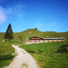
Hiking starting point Tourist Info, Scheffau (738 m)
Hiking starting point Tourist Info, Scheffau (738 m)
Hiking
Intermediate
5:45 h
18,0 km
540 Elevation gain
A circuit around the mountain that the locals love for its great view.
Hiking starting point Franzlhof, Söll (703 m)
Hiking starting point Franzlhof, Söll (703 m)
Hiking
Intermediate
6:00 h
17,8 km
670 Elevation gain
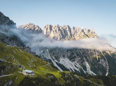
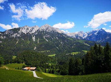
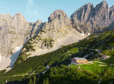
Hike to the Gruttenhütte with great views to the Ellmauer Halt and the entire region.
Hiking starting point Tourist Info, Scheffau (738 m)
Gruttenhütte, Ellmau (1,620 m)
Hiking
Intermediate
6:30 h
16,4 km
990 Elevation gain
Stripsenjochhaus – Stripsenkopf – Feldberg – Scheibenbichlalmen – Griesenau – Gasteig
Stripsenjochhaus, St. Johann in Tirol (1,577 m)
Gasteig (750 m)
Hiking
Intermediate
6:30 h
16,1 km
640 Elevation gain
Panoramic circular walk in the Wilder Kaiser leading to the highest mountain hut in the region.
Hiking starting point Tourist Info, Ellmau (800 m)
Hiking starting point Tourist Info, Ellmau (800 m)
Hiking
Intermediate
6:00 h
15,7 km
870 Elevation gain
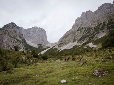
Is it about the journey or the destination? Well, one of the destinations of this stage is definitely the Hintersteiner See lake and its views. Surrounded by stunning mountain vistas, dwarf pine
Gaudeamushütte
Hintersteiner See
Hiking
Intermediate
6:30 h
15,1 km
888 Elevation gain
2024-05-14
21 °C
2024-05-15
19 °C
2024-05-16
18 °C
2024-05-17
13 °C